Don’t go chasing waterfalls in Cape Breton until you’ve read this. As it turns out, TLC was on to something. Maybe you should stick to the rivers and the lakes that you’re used to, and good news, Cape Breton has those in spades. Because social media will have you believing that chasing waterfalls is easy, and that is categorically false. Oh, you know I’m going to tell you why after the jump. But if you’re landing in Cape Breton for Waterfall Season, or any other time of year, you need two things, the truth, and the ability to be honest with yourself about what your body can actually do.
Before you type a waterfall’s name into your GPS and head off into the highlands with a full heart and half a tank of gas, here’s everything you need to know. I’ll tell you what happened to us at Egypt Falls, why your GPS is not your friend out here, and which falls are genuinely easy to reach, because there are plenty, and they are spectacular.
In this article
What happened at Egypt Falls, or, what didn’t
I’m going to be honest with you up front: we never actually made it to Egypt Falls. I’m telling you the story anyway, because the not-making-it is the most useful part.
Some context. Earlier that same day, at Port Hood, a cold wind took my twenty one year old daughter out. Not dramatically. No gust, no tumble. Just a cold wind off the water that seized up her muscles and quietly triggered a three day reaction. She has a chronic back condition, so she is, at twenty one, essentially travelling with the joints of an eighty year old, and Cape Breton’s coastline clocked that the second she stepped out of the car. So we arrived at Egypt Falls already a little battle worn.
We found the parking off Egypt Road and Pipers Glen Road with no trouble at all. Then, in the grand tradition of this trip, we set off down the wrong way. By the time we doubled back and found the right path down, her back was screaming, and she made the very sensible call that what she needed was to get back to the car. I was not about to send her up alone, so up we went together, and here is where I was reminded that going up that hill is dramatically harder than going down it.
This, dear reader, is where I had to make peace with how I might die. Would it be a heart attack, scaling my way back up after a winter spent firmly sedentary? Or would it be death by mosquito and noseeum, my body picked apart by a million biting bugs? Am I playing it up for drama? Yes. And also no, because in the moment I was genuinely weighing the pros and cons of each ending. Now, of course, I’m chuckling at my own ridiculousness from the safety of my desk.
My daughter, who could at least still breathe, went on ahead while I resigned myself to the climb, and somehow I made it back to the car. We did not see the falls. We were maybe a few hundred metres from one of the most photographed waterfalls on the island, and we turned around. And you know what? That was the right call.
The real kicker came next though. I got in the car, entered our home base into the GPS, and trusted it, because that is the entire premise of a GPS. It sent us the other way down the road. The dirt turned to gravel, the gravel grew water running across it, and on we went for eight of a promised twelve kilometres. I’m still not sure what that road was. A logging road, possibly. A test of character, definitely. Then, four kilometres before whatever turn we were supposedly making, the road was simply washed out. Gone.
And here is where my driving skills were really tested. There was nowhere to turn around. I reversed that car for a full kilometre, on gravel, with water crossings, before I found a spot wide enough to attempt what should have been a three point turn and was, in practice, closer to a fifty point turn. The cursing I did on that road was legendary.
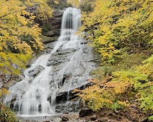
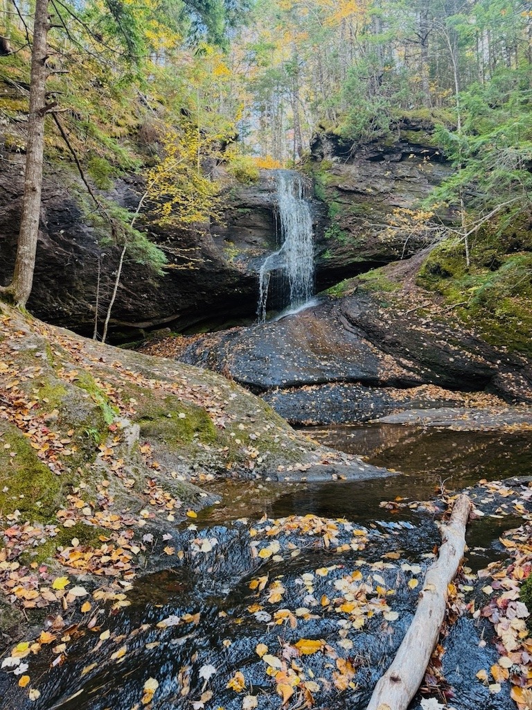
So no, I don’t have my own photo of Egypt Falls to show you. The one you see here is courtesy of Destination Cape Breton, and getting back there to take my own is officially on my list. I will be in better shape, I will leave the way I came in, and I will not be asking the GPS for its opinion.
New to the island?
Before you go chasing waterfalls, start with the big picture. My full guide to why you should visit Cape Breton covers what makes this island worth the drive, from the Cabot Trail to the Celtic music to the food.
Why you can’t trust your GPS when chasing waterfalls in Cape Breton
This is not just my bad luck. The roads to Cape Breton’s waterfalls change faster than the maps do. The most famous example is Mary Ann Falls in the Highlands National Park, where the access road washed out so many times that Parks Canada permanently closed it to vehicles and turned it into a hiking and biking trail. Your GPS may still cheerfully offer to drive you there.
Then there’s signage, or the charming absence of it. At Glenora Falls, we saw a sign on the main road, turned left, and that was the last sign we ever saw. We ended up on another dirt road to nowhere while I did quiet math about my rental car’s deductible. Myles Doyle Falls has no sign on the road at all, just flagging tape on the trees once you’re on River Denys Road. Washabuck Falls, same story. If you’re not watching for the pull off, you’ll sail right past it.
So here is my actual advice, earned in reverse gear:
- Look up the trailhead directions from Destination Cape Breton or the official waterfall app before you go, not just the waterfall name in Google Maps.
- Leave the way you came in. Do not let the GPS get creative with your route home. It does not know these roads. You now know these roads better than it does.
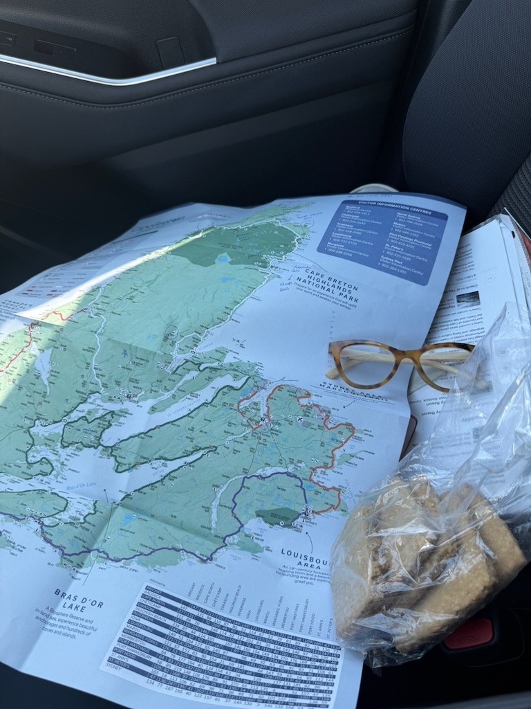
- Buy a paper map. I’m serious. It feels like a quaint souvenir right up until your phone service craps out and you need to reroute yourself, at which point it becomes the single most valuable thing in the car.
- If a dirt road starts feeling wrong, it probably is. Turn around while you still can. Trust me on the “while you still can” part.
- Expect no cell service. Screenshot your directions.
- Tell someone where you’re going, especially in the shoulder seasons when the rivers are high and the roads are soft.
Make it a road trip
Most of these falls sit along or just off the most beautiful drive in the country. Plan the whole loop with my Cabot Trail road trip guide, including where to stop, where to eat, and when to go for the best of the colours.
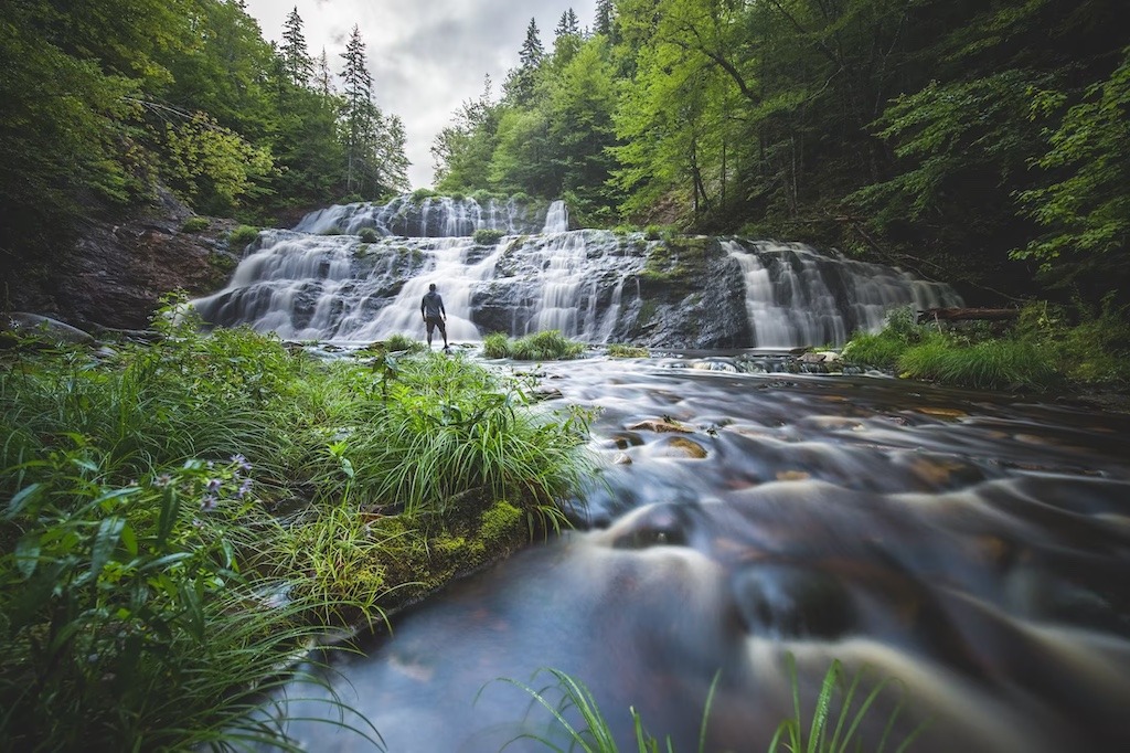
The ridiculously easy waterfalls in Cape Breton
Now for the good news, because chasing waterfalls in Cape Breton does not have to involve reversing down a mountain. Some of the loveliest falls on the island are almost embarrassingly easy to reach.
Beulach Ban Falls is about a minute from where you park. A minute. The gravel road in the Aspy Valley takes you practically to the base, and the falls tumble off the highlands like they’re showing off. If you do one waterfall on the Cabot Trail, this is the freebie.
Myles Doyle Falls is a short staircase down from River Denys Road, just off the Trans Canada near Melford, with a picnic table at the bottom and a pool that fans out over smooth rock. The catch, as mentioned, is that nothing on the highway tells you it exists. Watch for the road, then watch for the flagging tape.
Washabuck Falls, near Iona, is a few short steps from the road down a well worn path, with a bonus slide falls about a hundred metres downstream if you keep walking. Again, no signage. The locals know. Now you do too.
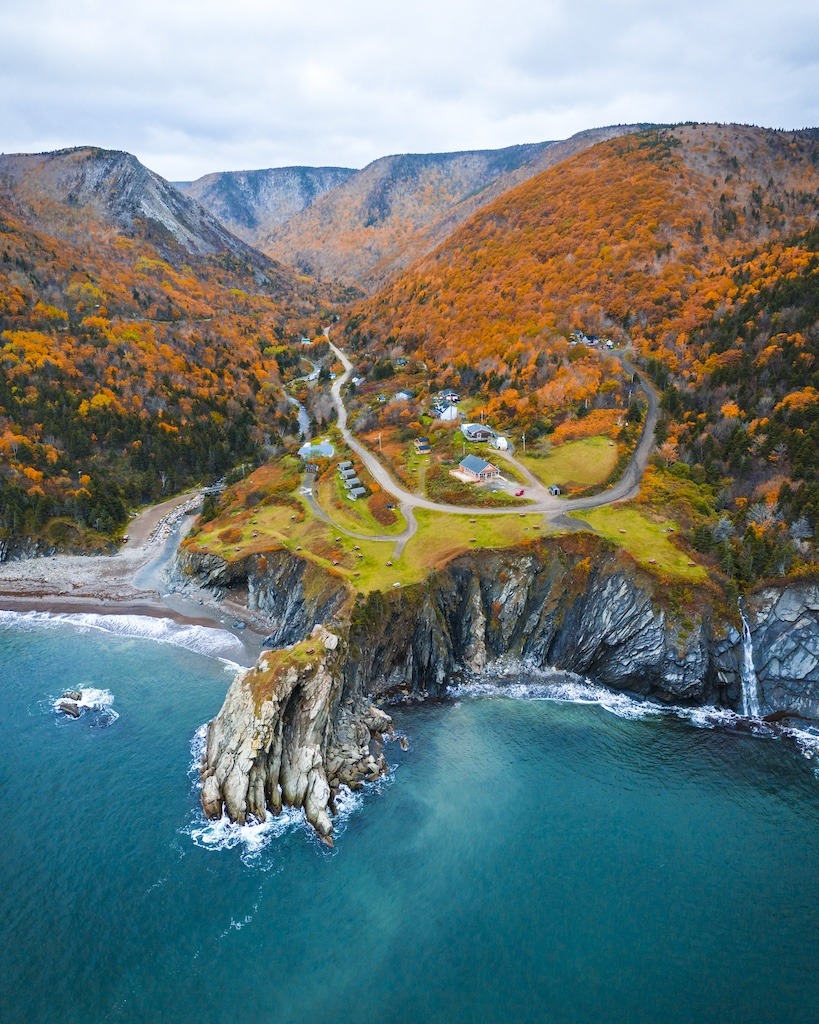
Black Brook, near Ingonish along the Cabot Trail, is a gorgeous cascade over pink granite with a pool you can actually get into. It’s a short walk in, and on a hot day it is perfection.
Worth a little more effort
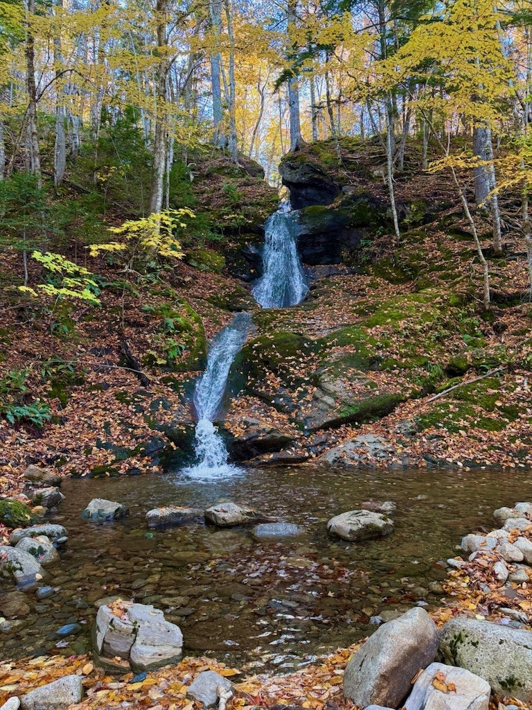
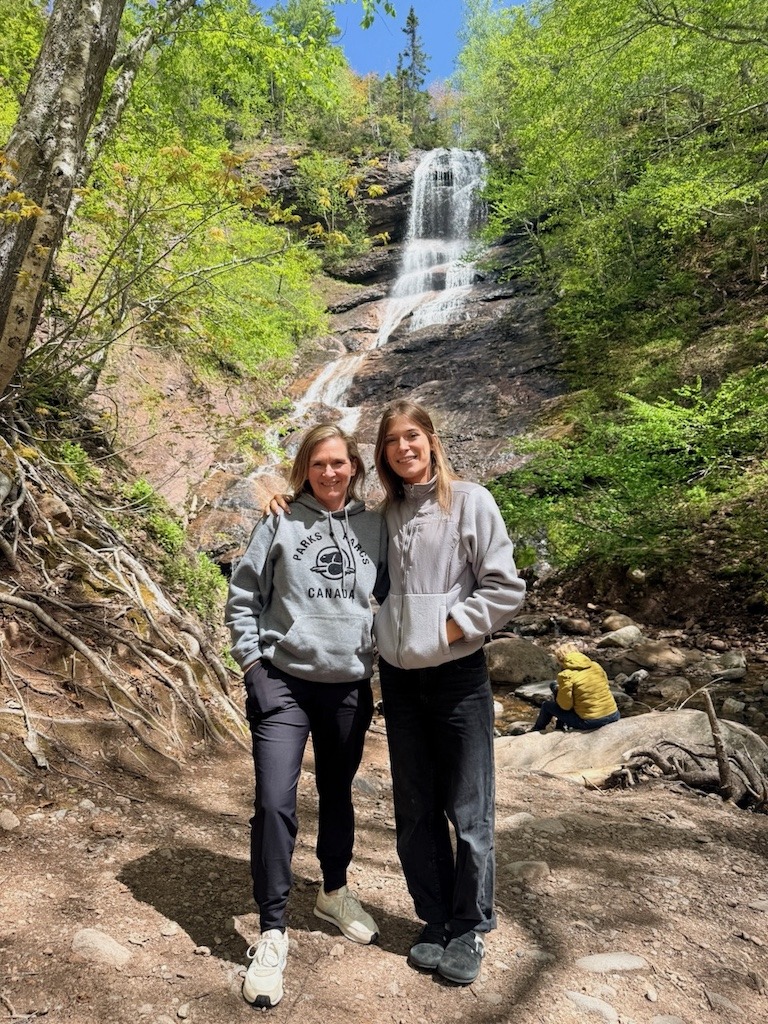
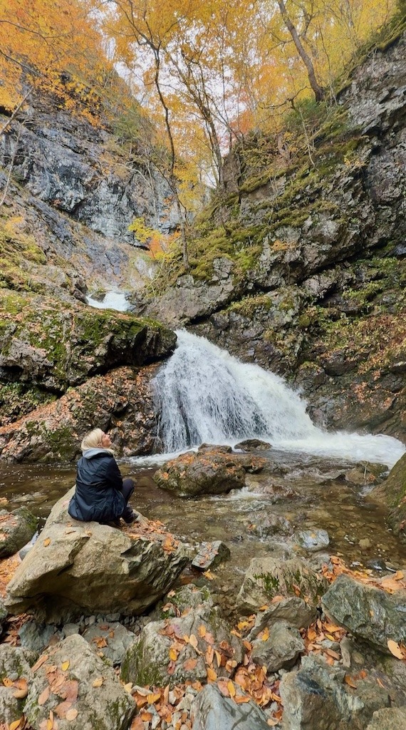
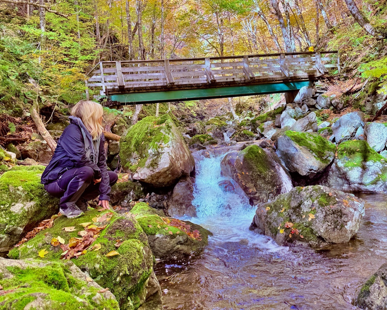
Uisge Ban Falls, near Baddeck, is the sweet spot. A 1.5 kilometre trail through hardwood forest, maple and birch and beech, ending at a 50 foot ribbon of white water. The name is Gaelic for white water, and it earns it. It’s a real walk but not a hard one, and it’s the fall I’d send most people to first.
The challenging ones
Egypt Falls is rated moderate to difficult, and I can now confirm the difficult part from personal, humbling experience. The trail drops steeply, with stairs and guide ropes, and the climb back up will introduce you to muscles you forgot you had and possibly to your own mortality. I didn’t make it all the way to the falls, but everyone who has tells me it’s worth every gasping step. Go in knowing what it is, take the correct route via Egypt Road and Pipers Glen Road, respect that you’re a guest on private land, and pace yourself on that climb.
Glenora Falls I cannot personally vouch for, because the signage abandoned us partway and we never found it. If you’ve made it, tell me how in the comments, ideally with turn by turn directions, because the road clearly isn’t going to.
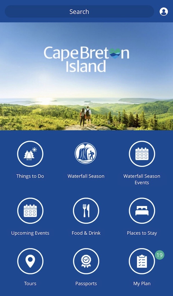
For everything beyond these, download the official Cape Breton waterfall app. It’s genuinely excellent, with trailhead directions, difficulty ratings, and the kind of detail that would have saved my rental car a very stressful afternoon.
When to go, or, a word about the bugs
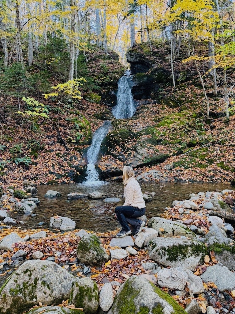
The official Waterfall Season runs through spring, when the snowmelt has the rivers roaring, and the falls truly are at their most dramatic. I’ve now gone chasing waterfalls in Cape Breton in spring, summer, and fall, and I’m going to commit a small act of tourism heresy: fall is the best time, hands down, even though it doesn’t get the official title.
Here’s why. You read what the climb out of Egypt Falls did to me, and the noseeums circling like they’d already filed the paperwork. That wasn’t a fluke. Whatever you’ve heard about declining insect populations worldwide, I can confirm there is no biomass problem on Cape Breton Island. The bugs are all here, in the spring and summer, in the woods, waiting for you specifically.
So if you’re going between May and August: bug spray is not optional, cover up even when it’s warm, and check yourself for ticks when you get back to the car. I’m not trying to scare you off. I genuinely think you should see these falls if you’re able. I just want you walking in realistic, sprayed, and sleeved. Or come in the fall, when the bugs have packed it in and the falls come framed in red and gold instead.
Want someone else to figure out the roads?
If chasing Cape Breton’s waterfalls and fall colour sounds like your kind of trip, but the reverse gear adventures do not, come with us. Colour and Connection is a seven night retreat in the Margaree Valley this October, for ten women who want the beauty without the navigation stress. I will handle the maps. You handle the camera.
See the Cape Breton retreatA love letter and a suggestion for Cape Breton tourism
Destination Cape Breton, if you’re reading this, first: I adore you. The waterfall app is fantastic and everyone should download it. Waterfall Season is a brilliant idea.

But here’s the thing. Most visitors aren’t finding your waterfalls through the app. They’re finding them on TikTok and Instagram, and then they’re typing a name into their GPS and trusting whatever road the algorithm picks, coming and going. Big, unmissable signs at the proper entrances would help. So would a sign at a trailhead like Egypt Falls saying, in effect, go back the way you came, this road ahead is not for tourist vehicles. One sign like that and my whole reverse gear adventure never happens. Billboards, even. I will happily consult. My rate is one order of oatcakes.
Chasing waterfalls in Cape Breton: FAQ
Not reliably, and not on the way out either. Access roads wash out, signage is sparse, and a GPS rerouting you “home” can send you down a road no tourist vehicle should be on. Use the official Cape Breton waterfall app or Destination Cape Breton’s trailhead directions, screenshot them before you lose service, leave the way you came in, and keep a paper map in the car.
Beulach Ban Falls in the Aspy Valley is about a one minute walk from the parking area. Myles Doyle Falls, Washabuck Falls, and Black Brook near Ingonish are also short, easy walks.
Yes, on two fronts. The drive requires the correct route via Egypt Road and Pipers Glen Road off Highway 395, and the trail itself is steep, with stairs and guide ropes. It’s rated moderate to difficult.
For the falls in this article, no, but several involve dirt or gravel roads that can be rough or washed out in spots. Drive cautiously, and if a road deteriorates, turn around early rather than late.
The official Waterfall Season is spring, when snowmelt has the falls at full volume. But having visited in spring, summer, and fall, I’ll say fall is the best time: the falls are still beautiful, the colours are unreal, and the blackflies, mosquitoes, and noseeums have finally stood down. If you go in spring or summer, bring serious bug spray, cover up, and check for ticks afterward.
 Why Is Everything So Pleasant Around Here?
Leave a Reply